Porto-North-Portugal.com
The best independent guide to north Portugal
Porto-North-Portugal.com
The best independent guide to north Portugal
Valenca Portugal: day trip, and suggested tour
Valenca is as far north in Portugal that you can travel by train and is deep within the lush Minho region of Portugal. The town is set in an idyllic location, surrounded by craggy mountains and wide rivers, and the Rio Minho forms the natural border with Spain.
Valenca was historically the focal point for the defence of northern Portugal from its larger neighbour, and along the banks of the slow flowing river, a massive fortification was constructed to deter invasion. Today the Spanish invasion is of a different form, as hordes of bargain hunting Spanish flock to the city to purchase cheap linear and cloth items.
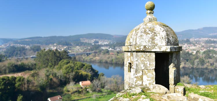
Valenca guarded Portugal from attack across the Rio Minho
The Valenca Fortaleza is one of the most impressive fortifications in northern Portugal, and the multilayers of battlements and bastions encompass the entire historic centre. This historic centre is scenic and characterful, while the newer residential section of the city is drab and best simply avoided.
For tourists Valenca offers an extensive fort complex to explore, a delightful historic centre and the chance to stroll across the river into Spain. As Valence is the final stop on the regional railway it does not require a rental car to explore and can be easy visited as a day trip from Viana do Castelo.
Highlights of Valenca Portugal
• Exploring the labyrinth of fortifications, submerged passages and jutting watchtowers
• The view from the Baluarte Do Carmo (Carmo Bulwark) across the Rio Minho river to the Spanish fortified rival town of Tui
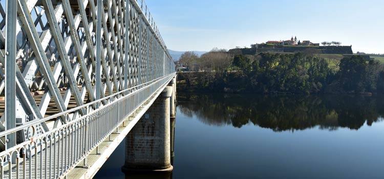
The Ponte Internacional bridge connects Valenca and Portugal with Tui and Spain
• Crossing the Ponte Internacional bridge into Spain and the view of the impregnatable Valenca Fortaleza from Spanish lands
• The baroque Igreja de Santo Estevão and the unique painting of Mary feeding baby Jesus
• The numerous textile and linen shops selling high-quality products
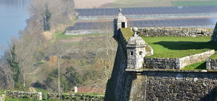
The towers, battlements and height advantage of the Fortaleza Valenca fort
How long to spend in Valenca?
Valenca is ideal as a day trip, and all of the main sights can be easily seen within three hours. Add a wander around the perimeter of the battlements and leisurely lunch would create a full day of sightseeing.
Once all of the Spanish shoppers leave for the day, the historic centre is peaceful and atmospheric, with restaurants filled with locals. There is no need to spend a night in Valenca but early mornings and dusk are the best times to explore. If you do choose to stay a night always be based within the Valenca Fortaleza and historic centre.
Suggested Itinerary for a day trip to Valenca
The following is a suggested route for a day tour of Valenca.
• If arriving by train - the train station is to the south-east of the historic centre (GPS 42.02483, -8.63966). Walk briskly through the non-descript town centre to the Portas do Sol (GPS 42.03007, -8.644058)
• If arriving by car - there is a car park in the southern fort (GPS 42.02826, -8.64625) but to get there requires navigation of the narrow roads in the historic centre. It’s generally easier to park just outside of the Portas do Sol (€1 per day GPS 42.02985, -8.643685)
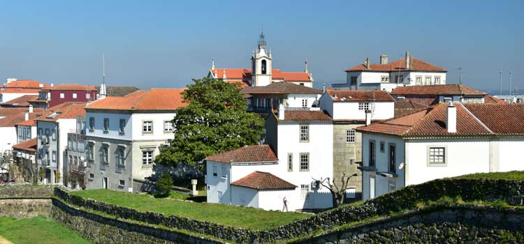
The historic centre of Valenca
• The main tourist information office of Valenca is on the right (north) side of the Portas do Sol and it’s a good location to grab a free map (GPS 42.03009, -8.644022)
• From the tourist office walk to the main shopping street and turn right, this leads to the Praça da República which is overlooked the town hall (GPS 42.03051, -8.644601)
• Continue along the busy (at the weekends) shopping street of Rua de Mousinho de Albuquerque
• Take a side detour to the Igreja de Santo Estevão (GPS 42.031704, -8.644618). The church has a common Portuguese baroque exterior, but the interior is beautifully decorated. In the Alcove to the right of the Alter is an image of Mary breastfeeding the baby Jesus which is extremely rare for Portuguese religious art.
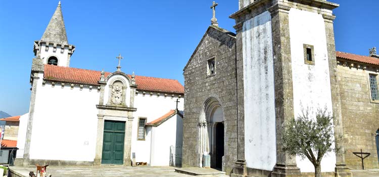
The Largo de Santa María dos Anjos, count the number of cats
• Further along the Rua de Mousinho is the old prison which has been converted into the Núcleo Museológico de Valença
• Found at the end of the shopping street is Valença’s most scenic plaza, the Largo de Santa María dos Anjos (GPS 42.03266, -8.64554). On this plaza is the Igreja St Maria dos Anjos, an ancient (1276) and delight church, which is our favourite of the entire town.
Random sight: The residents of the Fortaleza Valença have a love of cats (not sure why), and the Largo de Santa María dos Anjos are the cats favourite hangout. The longer you spend in the square the more appear…
• Beyond the Largo de Santa María dos Anjos is the Baluarte Do Carmo (GPS 42.03272, -8.64639) the best viewpoint of Valenca. From this vantage there are views over the Rio Minho and the Ponte Internacional, the original border crossing point. (Following this tour, the bridge will be crossed later in the day)
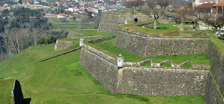
The many layers of defences of the fortress, with the Baluarte Do Carmo in the background
• Trace the western fortifications around to the Portas do Meio (GPS 42.02974, -8.644766) on the southern side of the fort. This is an opportunity to explore some of the quietest sections of the battlements, which can be accessed by tunnels.
• The raised walkway from the Portas do Meio connects the two distinct sections of the fort.
• The southern section of the Fortaleza Valença has much less to see, with a significant portion converted into a carpark. The main sight is the pretty Capela do Bom Jesus (GPS 42.02841, -8.64550) and the equally attractive Largo do Bom Jesus.
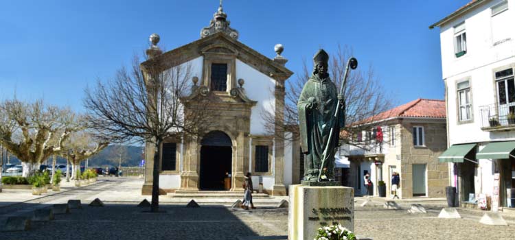
The Largo do Bom Jesus
• It’s probably close to lunch time and the Rua Apolinário da Fonseca has a selection of good restaurants. Don’t forget to have a coffee at the end of your lunch as the afternoon contains most of the walking.
• Head back into the northern section of the Fortaleza Valença via the Portas do Meio.
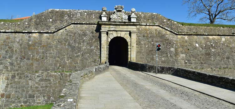
The Portas do Meio connects the north and south sections of the fort
• Walk to the Casa do Poço de Valença (42.03276, -8.64505) at the northern end of the town. For this we suggest following eastern perimeter of the fortress walls, as by now shopping streets could be filled with Spanish shopping tourists.
• The next section descends from the fort to the Ponte Internacional bridge and passes through the quietest sections of the defences.
• The cobbled street to the right of the Casa do Poço passes through the heaviest defence and there are multiple right-angle corners. These abrupt turns prevented attackers from using siege engines on the gates, unfortunately there is very poor lighting here.
• On exiting the walls (GPS 42.03320, -8.644837) turn left. This section of the walk follows the Caminho de Santiago (a 610km pilgrimage from Lisbon to Santiago de Compostela).
• Before reaching the Ponte Internacional are the old custom houses, which are now abandoned (GPS 42.03455,-8.64484)
• Cross the Ponte Internacional and admire how well defended the Fortaleza Valença actually is.
• Halfway along the Ponte Internacional is the border with Spain, and the actual crossing point is only vaguely indicated.
Note: This is an official border only cross if you have correct visas and paperwork.
• On the opposite side is the Spanish city of Tui, but the historic centre is 1.5km from the bridge and generally is too far to walk for a day trip.
• Take the obligatory photos of the Spanish (EU) sign and cross the bridge back to Portugal.
• From here head back either to the train station or to the car park.
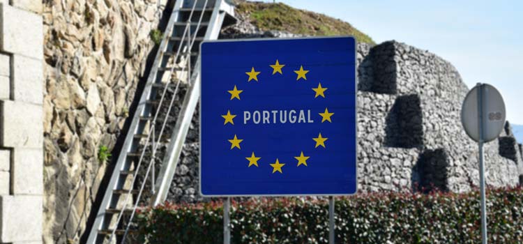
The sign welcoming you back to cheap linen, and Portugal
For each of the sights we provide GPS coordinates, which can be copied and pasted into any of the map application used by the main search engines. When we explore anywhere new we use the very detailed and free maps of OpenStreetmap.com or the associate phone app “OsmAnd”.
If you've found our content valuable, we'd welcome your support.
The digital publishing landscape has evolved significantly. As a small independent publisher, we face growing challenges. Search engines increasingly favour paid content over organic results, while AI-generated content often reproduces original work without attribution.
To support our work, please consider bookmarking this page (press Ctrl + D) for quick access. If you find an article helpful, we'd be grateful if you'd share it with friends on social media.
For specific questions, please see our Reddit community at r/LisbonPortugalTravel.
Should you notice any outdated or incorrect information, please contact us at [email protected]
Thank you for helping us continue to provide valuable content in an increasingly challenging digital environment.


